|
|

|
Hokusai - Ehon Sumida Gawa - Prints 1-7 and 1-8
|
|
|
|
The season now shifts from winter into spring ...
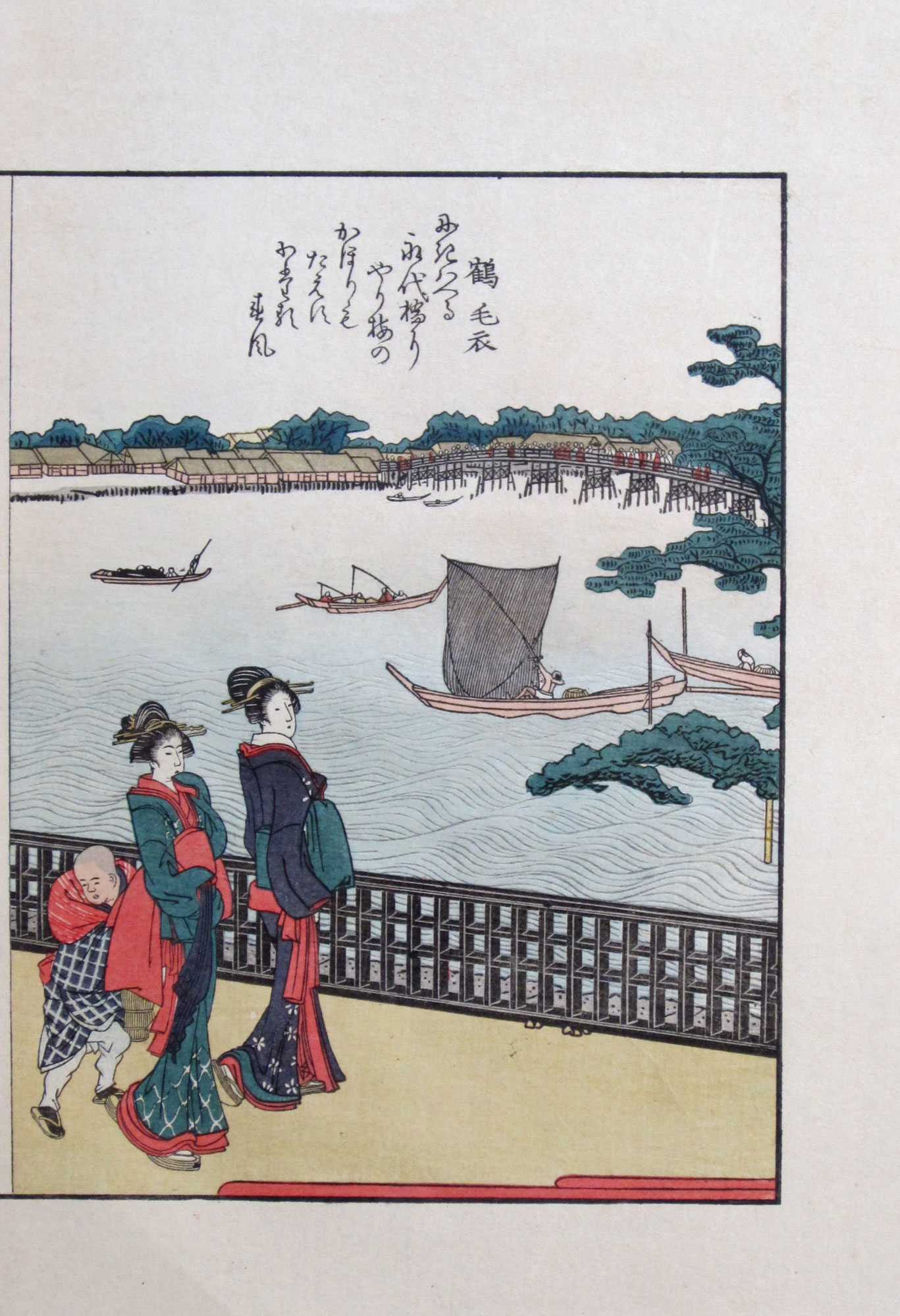
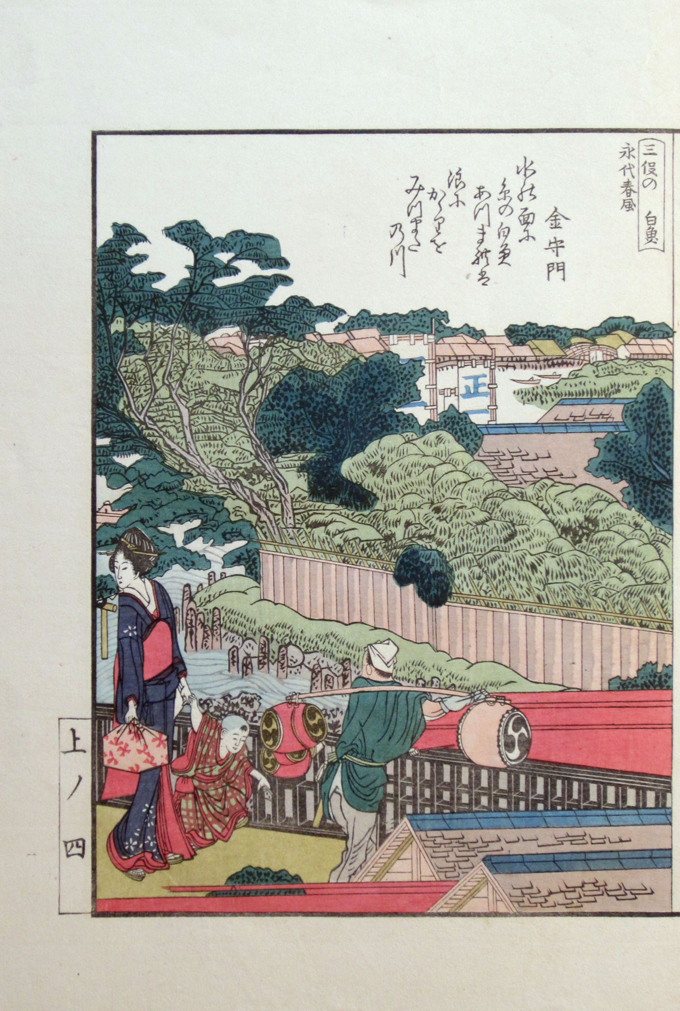
Eitai bridge (永代橋, which translates into “Perpetual bridge”) - loaded with people - is seen in the further distance on the right of print 1-8. It was built in 1698 and is more than 200 meters long; it connects the Nihonbashi (日本橋, meaning “Bridge of Japan”) district in the foreground with the Fukagawa (深川) district located on the east bank of the river. According to the kyōka (comic poem) in print 1-8 blossoms of the plum trees growing at this point could be smelled as far as Eitai bridge.
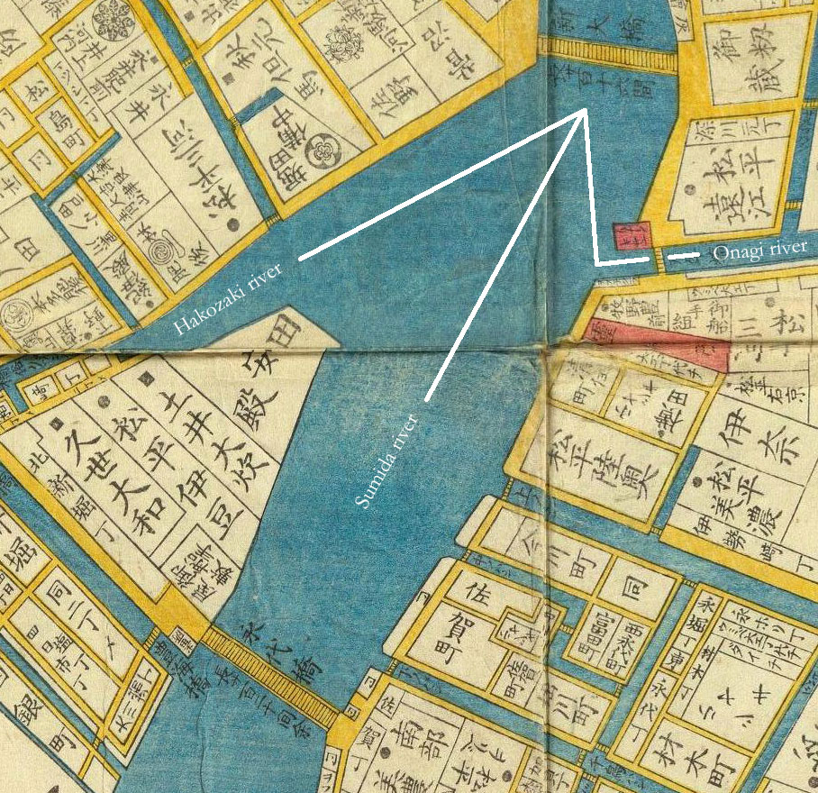
The name Mitsumata (三俣) in the title of print 1-8 translates into “three-fork”, referring to the fact that the water of the Sumida river - being at its widest at this point - forks in three different directions here. In the center, the main river flows on under Eitai bridge into Edo bay. Off to the right the water flows under Eikyū bridge (永久橋) into the Hakozaki river (箱崎川) which continued on to the Nihonbashi district. And off to the sharp left it flows under Mannen bridge (万年橋) into the Onagi river (小名木川) which crossed the Fukagawa district and connected the Sumida and Nakagawa rivers. Here is how this looks on a detail of this Edo map of 1858 (click to enlarge):
|
Mitsumata on Edo map |
The number three also resounds in the mitsu tomoe (三巴) appearing on the skin of the drums carried by the man in print 1-7. A mitsu tomoe - an abstract shape in the form of a triplicate whorl - is particularly identified with Shintō religion, and a common design element in Japanese family emblems and corporate logos.
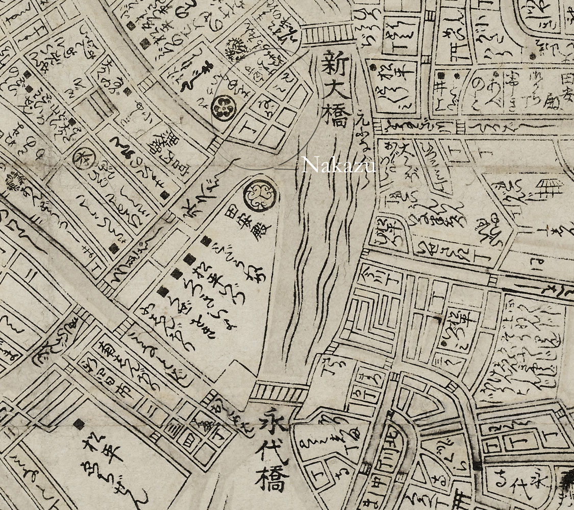
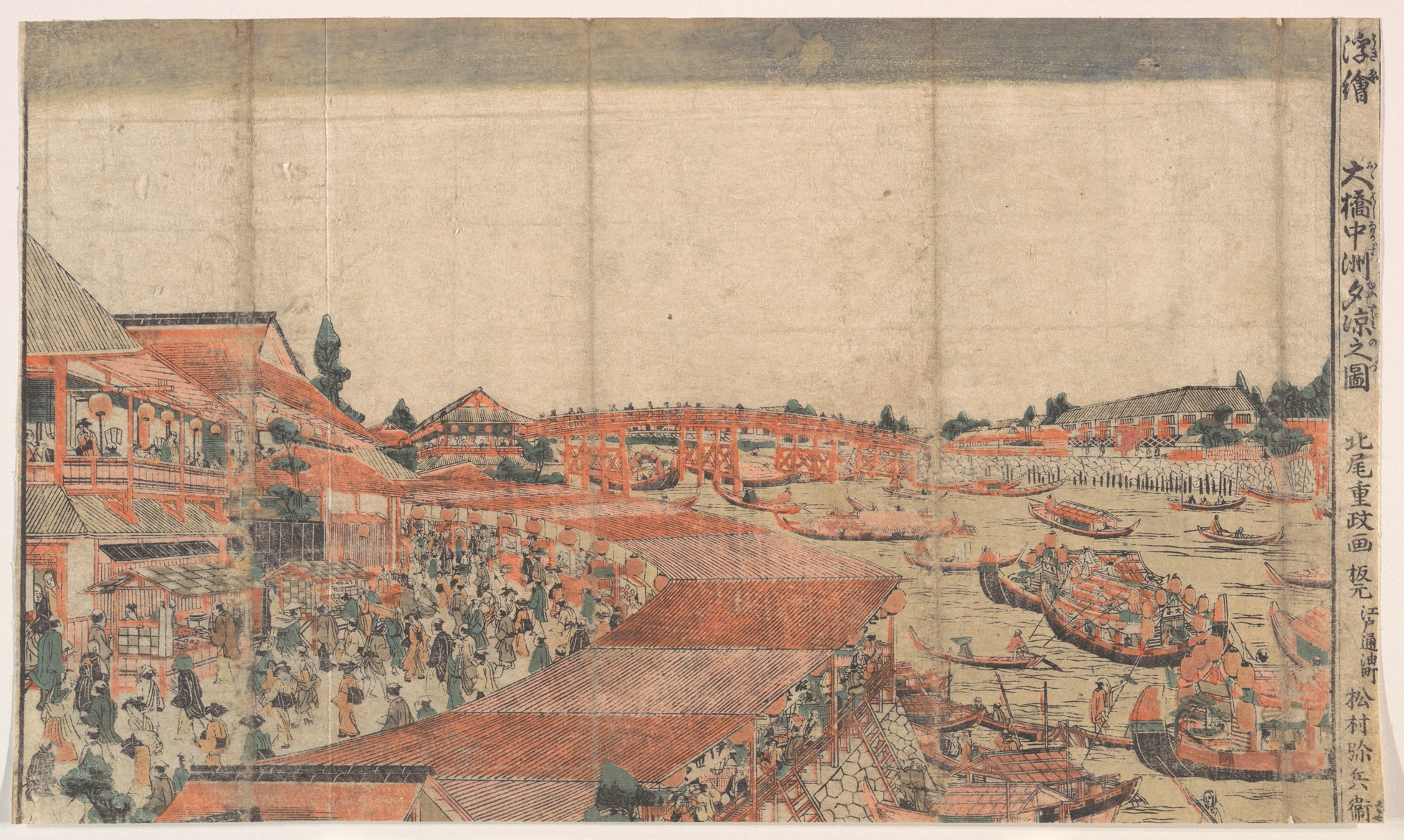
Between 1771 and 1789 the famous Nakazu (中洲, which translates into “sandbank in a river”) pleasure quarter was located right in front of this part of the west bank of the Sumida river which already had long been popular as a cool place to anchor pleasure craft during the stiffling hot summer season. Landfill was brought from in front of the boat sheds of the shōgun (see prints 1-13 and 1-14 and prints 1-15 and 1-16) and dumped into what was already a shallow part of the river. Offering such diverse distractions as boating parties, fireworks, moon viewing, riverside teahouses, street stalls, fancy restaurants, bath houses, unlicensed brothels, circus, and other weird and exotic street entertainments, during its short existence Nakazu ended up attracting such large crowds that it temporarily became more popular than the Sumida river banks surrounding Ryōgoku bridge.
Here is a detail of an Edo map of 1785 displaying Nakazu that I was able to obtain from the London British Museum (click to enlarge):
|
Detail of an Edo map of 1785 showing |
This woodblock print depicting Nakazu designed by Kitao Shigemasa was published in the late 1770s (I apologize for the bad quality, but it was the most detailed version of this print that I could find on the internet so far):
|
View of Enjoying the Evening Cool at Nakazu, Ōhashi |
It is a view from the bank of Hakozaki river looking out towards Shin Ōhashi bridge. Nakazu is shown on the left with Shin Ōhashi bridge (see also prints 1-9 and 1-10 and prints 1-11 and 1-12) in the further distance. The then famous two-storey Shikian restaurant is visible just in front of this bridge.
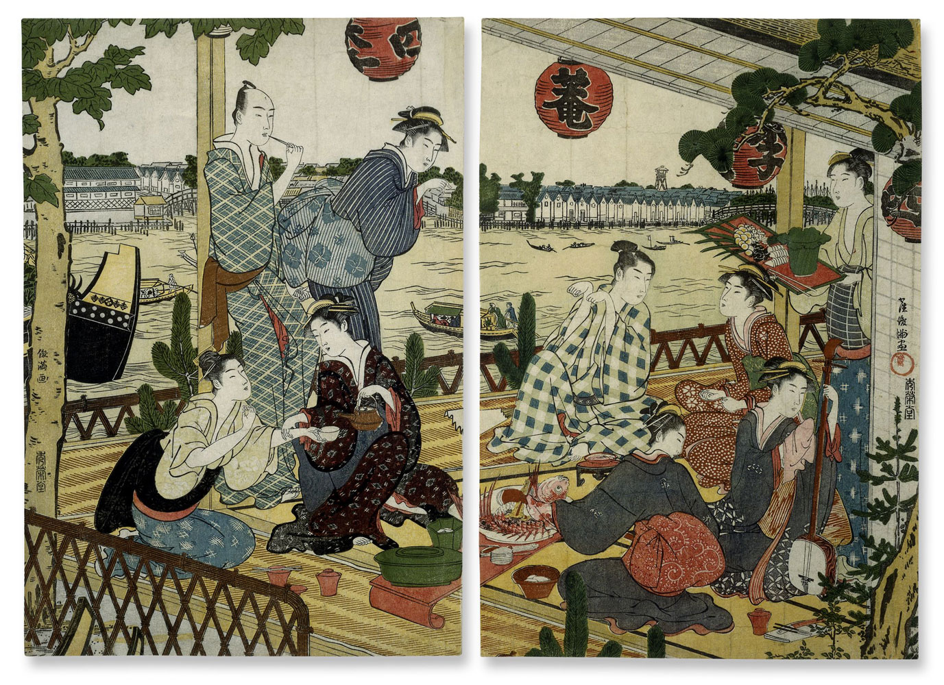
This is a diptych with a view from within restaurant Shikian (四季庵 which translates into “Four seasons retreat”; these three characters are also written on the red lanterns):
|
A party at the Shikian restaurant |
The view outside is of the storehouses of Fukagawa on the east bank of the river with most probably the residence of Matsudaira from Tōtōmi province and Mannen bridge on the extreme left (see also prints 1-9 and 1-10) and Eitai bridge on the extreme right.
A triptych containing another view of Eitai bridge (and Tsukudajima island) published around 1830 can be seen below. The bridge across the canal flowing into the Sumida river on the right of Eitai bridge in this triptych is Toyomi bridge (豊海橋).

|
Eitai bridge and the reclaimed land at Fukagawa. |
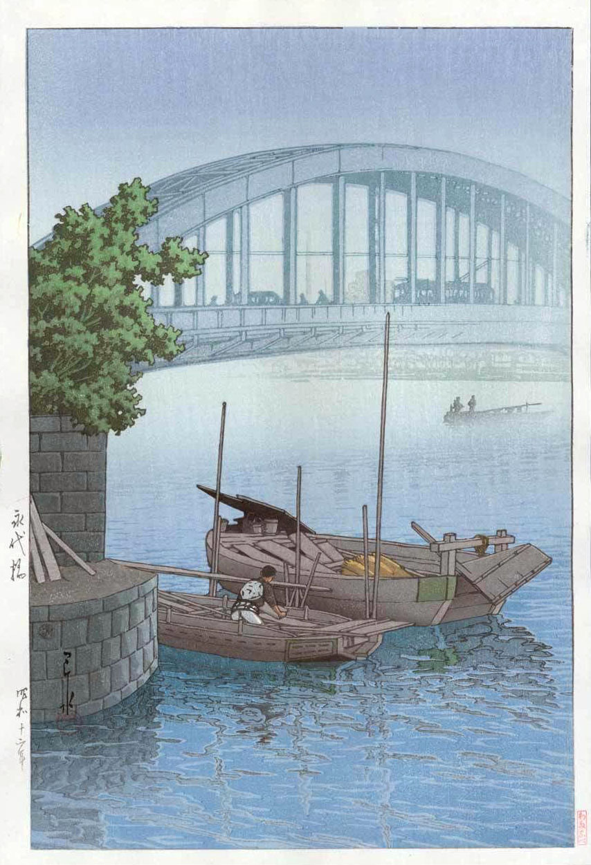
In 1924 the original Eitai bridge was replaced by this modern bridge:
|
Eitai Bridge by Kawase Hasui (1937) |
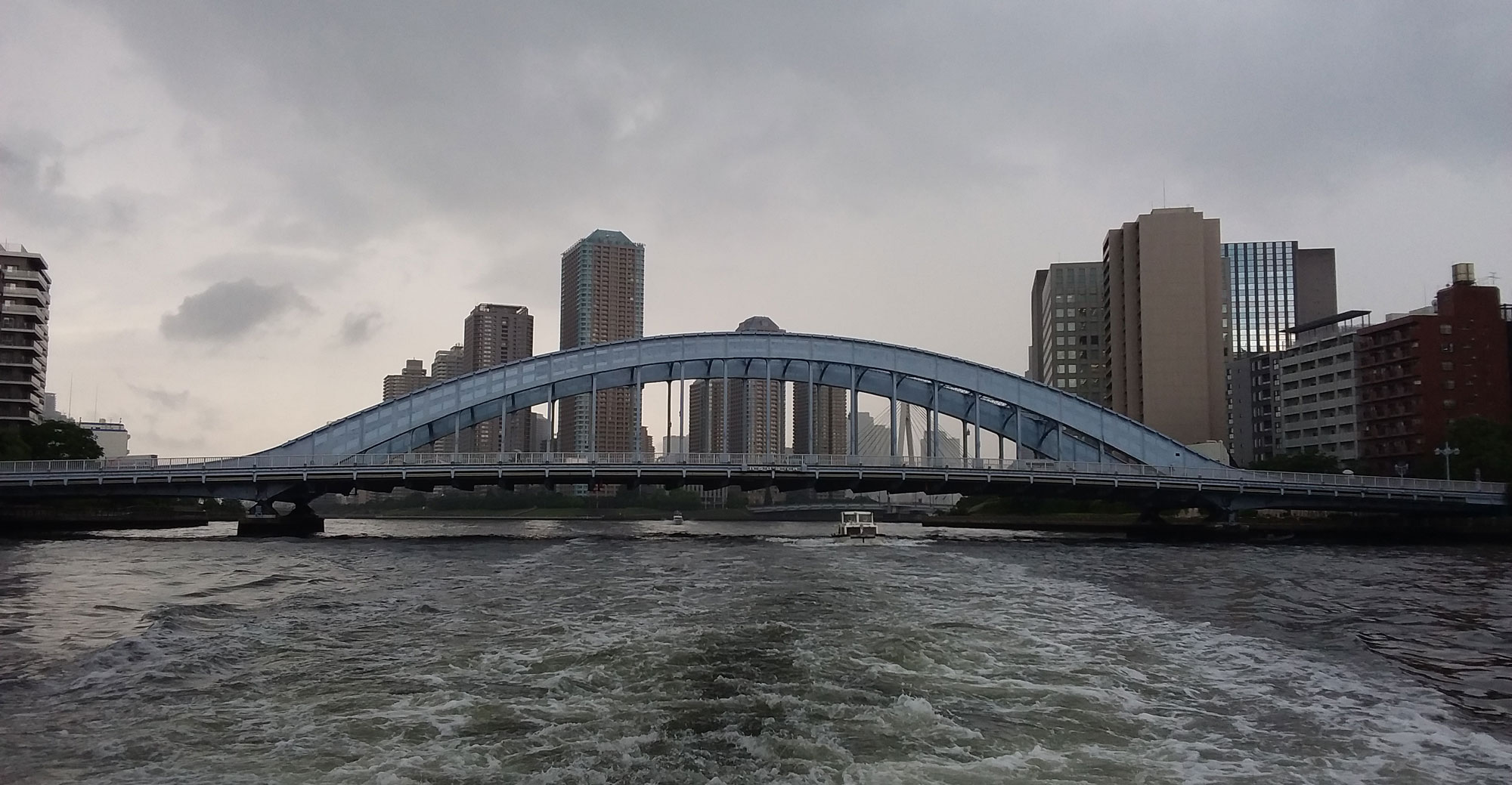
and here is a photo I took of Eitai bridge while visiting Japan in 2017:
|
Eitai bridge today |