|
|

|
Hokusai - Ehon Sumida Gawa - Prints 1-5 and 1-6
|
|
|
|
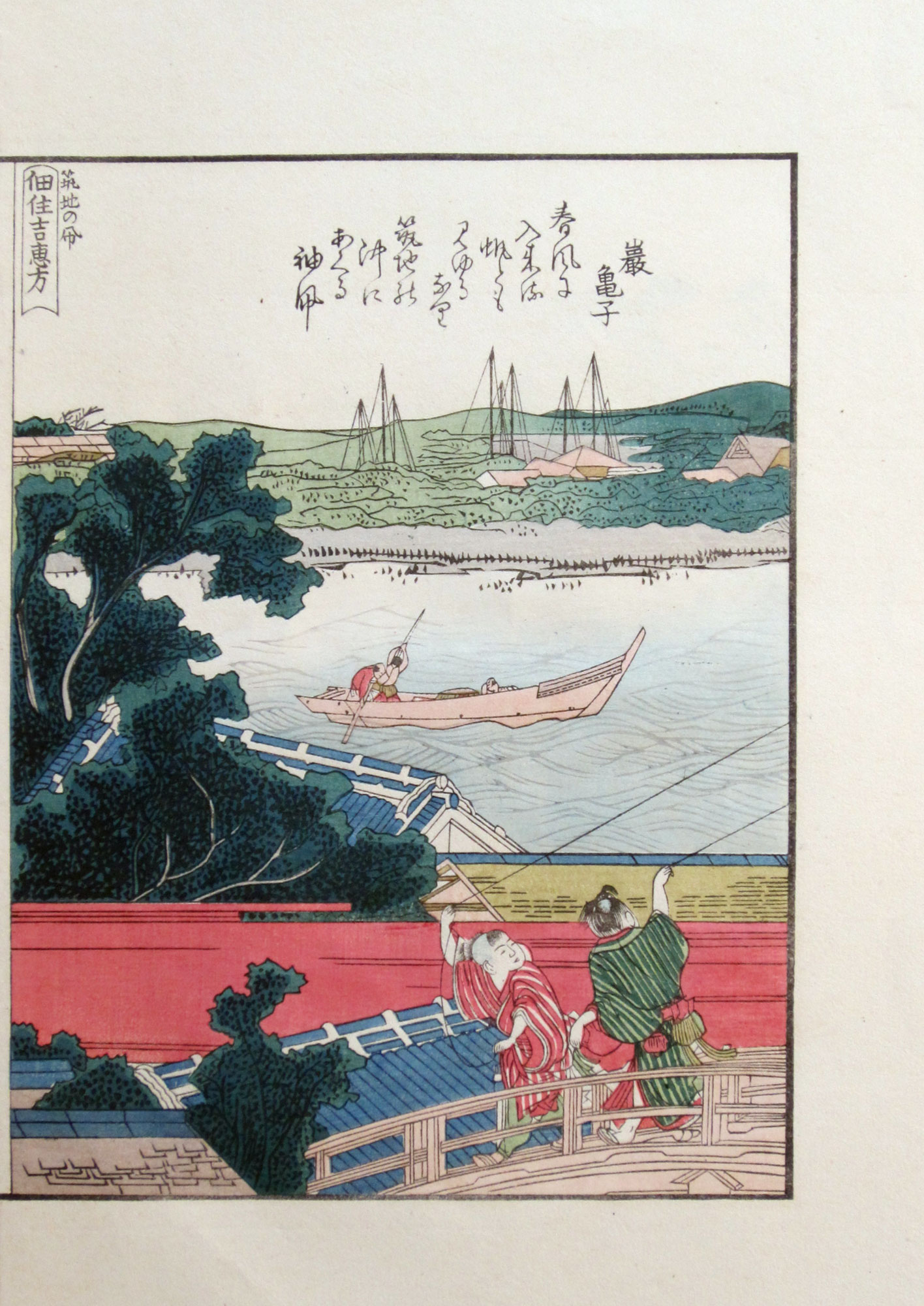
Moving up north from the coast of Takanawa - and looking out from the west to the east coast of Edo bay - we see Tsukudajima island in the mid distance. At that time this island was mostly populated by fishermen who used to catch little shirauo (白魚, meaning “white fish”) during the winter through summer seasons. Part of this catch was for the shōgun in Edo castle, part of it was sold at Nihonbashi fish market. In English these little white fish are known as “ice goby”, their official Latin name being “leucopsarion petersii”. In Japan shirauo - eaten raw, and sometimes even alive - are considered to be a delicacy.
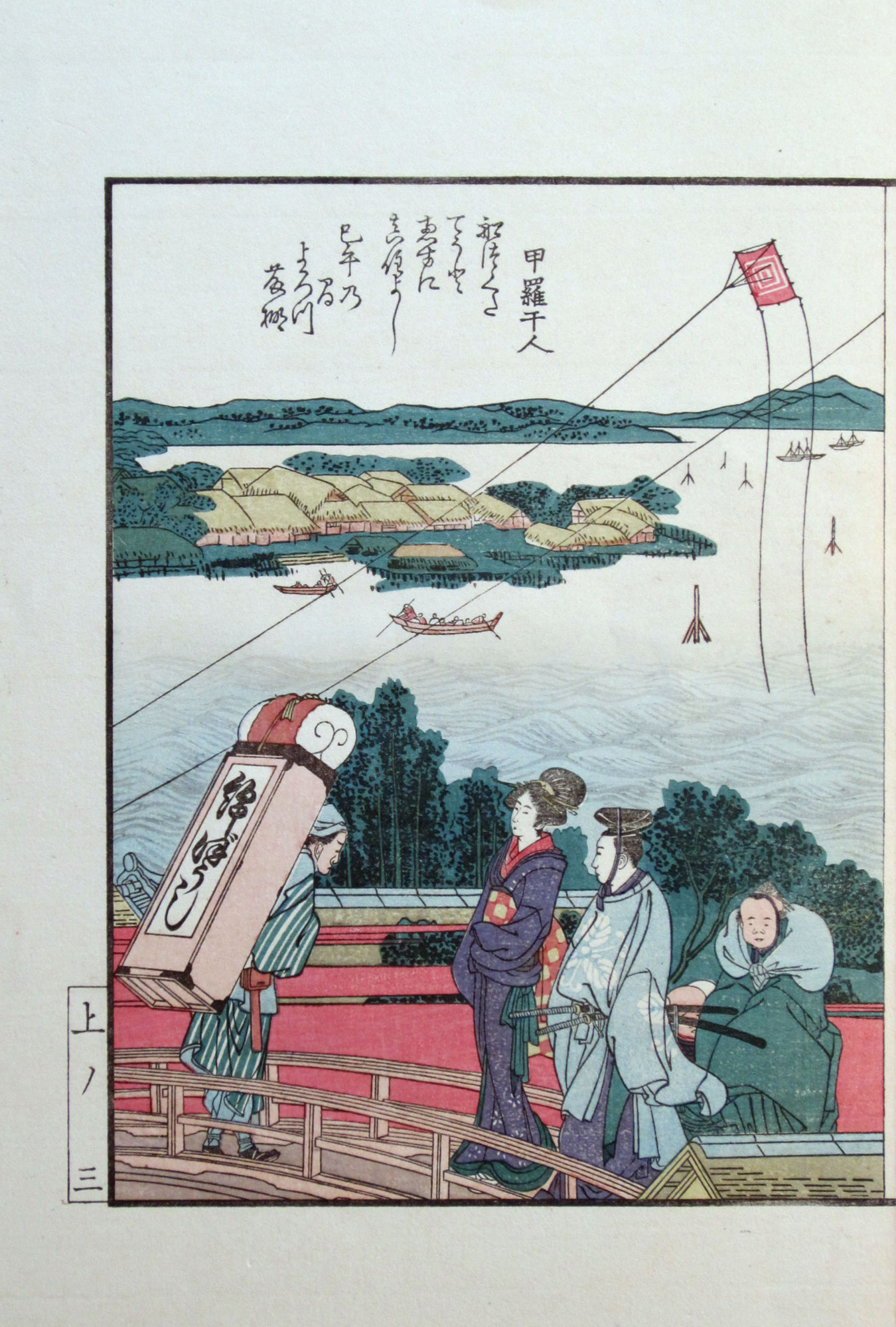
The “happy direction” mentioned in the title of print 1-5 is the south east. The Sumiyoshi (住吉) shrine on Tsukudajima island whose protruding roof can be discerned by enlarging (i.e., by clicking, and then clicking again on) print 1-6 is located at the south east of the city of Edo, and is therefore in the “happy direction”.
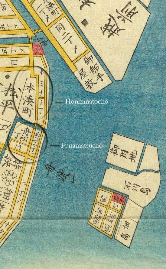
The bridge in the misty foreground of these two prints connects the quarter of Funamatsuchō (舟松丁) located on the right of the bridge with that of Honminatochō (本湊町) located on its left, as is also confirmed in this Edo map of 1858:
|
Detail of an Edo map of 1858 displaying the bridges |
The two boys in print 1-6 are flying kites, which is another Japanese symbol of the New Year. The kite with sleeves handled by the boy on the right of print 1-6 hovers all the way above Tsukiji (築地) in print 1-4. This is a clever ploy used by Hokusai to cover the otherwise impossible distance between Takanawa and Tsukiji without disrupting the continuous flow of the presentation.
Tsukiji - which literally means “constructed land” - was built on reclaimed land out of what were once lowland marshes along the Sumida river delta. Throughout the Tokugawa period which spanned the years between 1600 and 1868, earth from the shogunate’s extensive moat and canal excavations was systematically used to fill in the marshes along the river, creating new commercial districts and waterfront housing.
The great fire of Meireki in 1657 destroyed over two-thirds of Edo’s buildings, including the Honganji temple in Asakusa, the enormous Kantō headquarters of the Buddhist Jōdo Shinshū sect. As a result, the temple site was relocated to Tsukiji, where many of the residents of the nearby island of Tsukudajima were instrumental in its reconstruction.
Some three centuries after the Meireki fire the great Kantō earthquake of 1923 destroyed the Nihonbashi fish market which was then also relocated to Tsukiji, resulting in the now famous Tsukiji fish market.
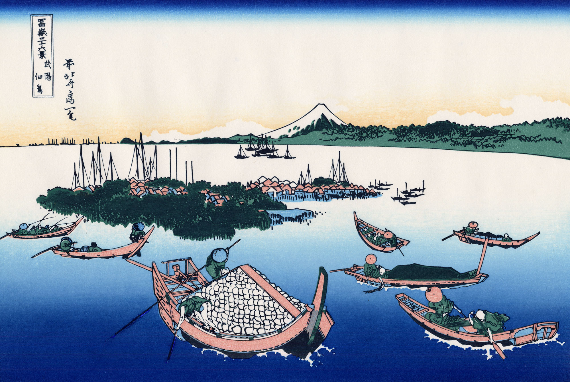
About thirty years later Hokusai designed this second print of Tsukudajima island for his famous “Thirty-six Views of Mount Fuji” series:
|
Tsukudajima island in Musashi Province from the |
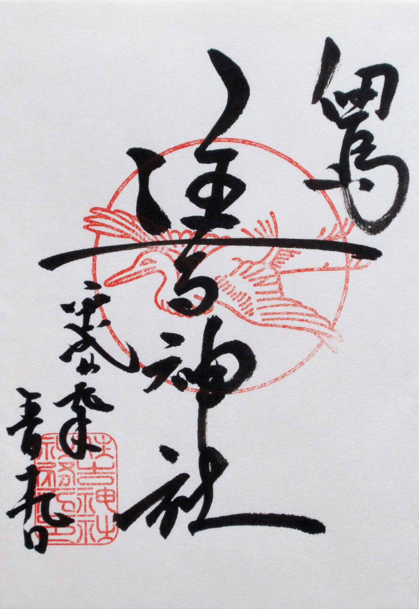
Here are two pictures I took of Tsukuda Sumiyoshi shrine in 2017 as well as the stamps and calligraphy I obtained from a priest at the Sumiyoshi shrine in my goshuinchō temple stamp book (click to enlarge):
-large.jpg)
|
|
-large.jpg)
|
The kanji in the calligraphy in the two bottom left columns of my goshuinchō book page are 平成二十九年五月十九日. This translates into Heisei 29, the 5th month, the 19th day, and thus in 2017, May 19: the date of my visit to the shrine. The kanji in the middle column on the torii gate on the right are 住吉神社: Sumiyoshi-jinja shrine.