


Hokusai’s simultaneous views of both banks of the Sumida river
This website is completely dedicated to the three picture books with simultaneous views of the banks of the Sumida river designed by Katsushika Hokusai (葛飾北斎) (1760-1849) and published by Tsuruya Kiemon (鶴屋喜右衛門) around 1803. The Japanese title of these picture books is 絵本隅田川両岸一覧, which is pronounced as Ehon Sumidagawa ryōgan ichiran and translates into “Picture books with views of both banks of the Sumida river”.
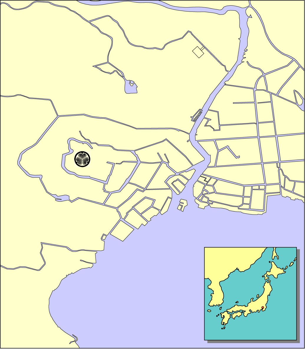
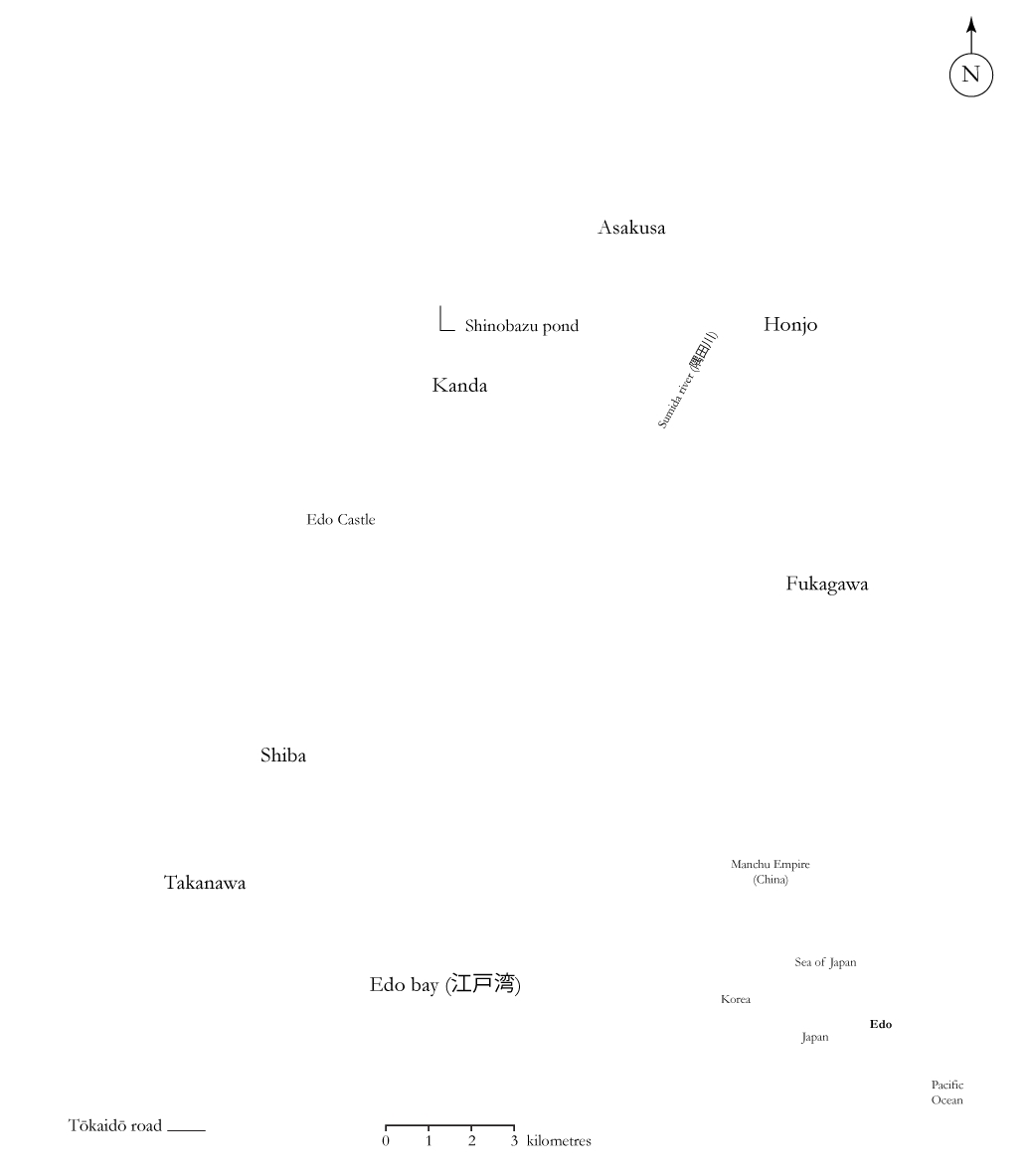
Although published some 40 years later, the following 1843 map of Edo (current day Tokyo) still provides a very good idea about which parts of the banks of Edo bay and of the Sumida river were displayed in Hokusai’s three picture books.
Moving your mouse over this map from 1843 and clicking on the context sensitive areas will transfer you to more detailed maps of Edo. The same can be achieved by using the menu’s at the top of this page. Context sensitive spots in the more detailed maps of Edo will then link you to the actual prints in Hokusai’s picture books.
I hope you’ll enjoy the ride!
Here I would like to thank Serge Astières for his generous help in getting this website at its current level, and for his all-round encouragement and support. Among other things, Serge helped me to solve the bamboo storehouse puzzle (“the name implies there must be a storehouse somewhere but where the heck is it?”), provided me with many pictures and information related to Hokusai’s Ehon Sumidagawa prints, and advised me on obtaining an at least acceptable romaji translation of Japanese terms and names. Any remaining omissions or mistakes are my sole responsibility of course.
For additional information, questions and/or comments, please feel free to contact me by email at jacquesc@xs4all.nl.
July 14, 2014
Jacques J.F. Commandeur