|
|

|
Hokusai - Ehon Sumida Gawa - Prints 2-13 and 2-14
|
|
|
|
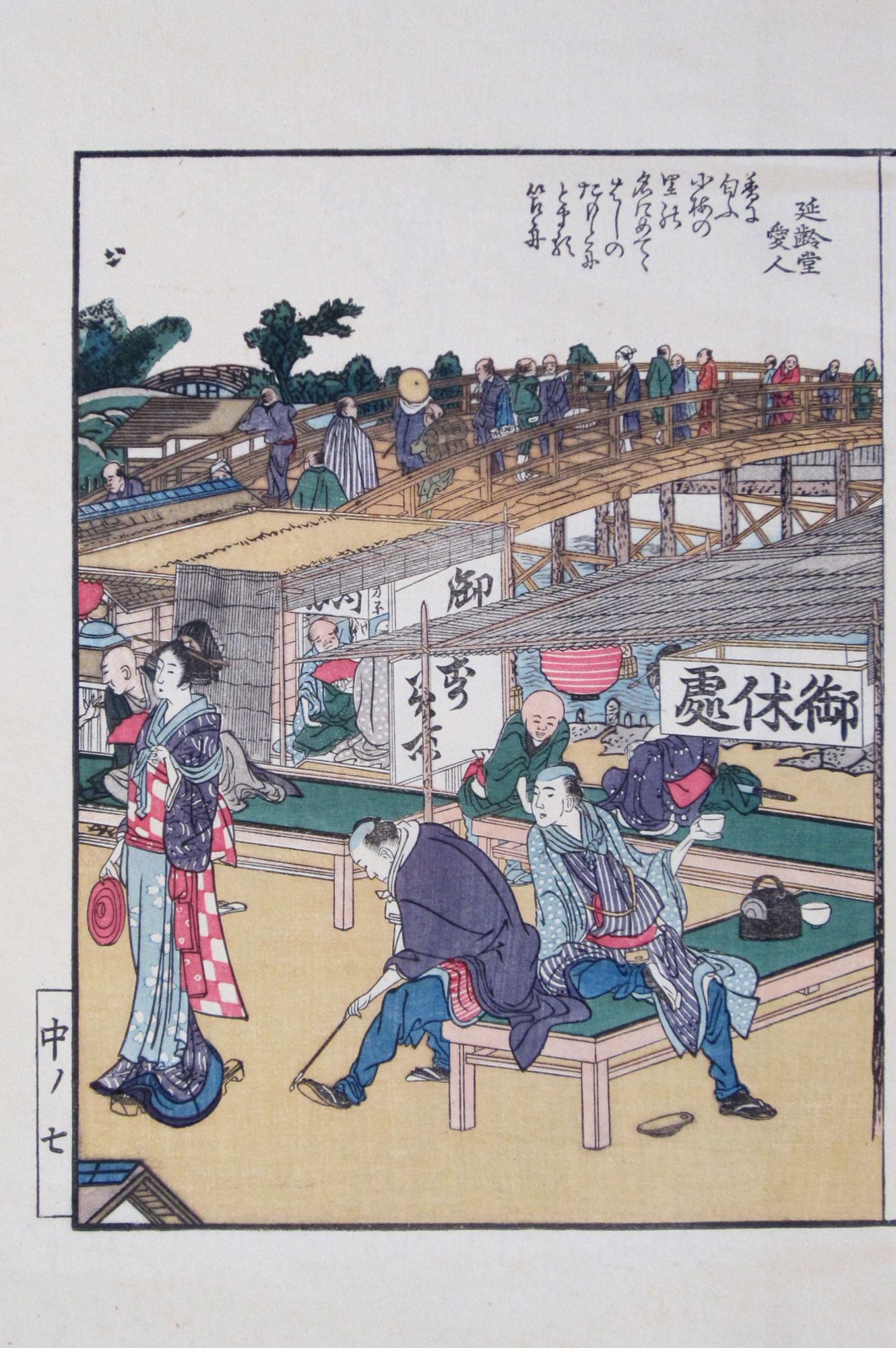
The large bridge crossing Sumida river in the mid-distance is Ōkawa bridge (大川橋, which translates into “Large river bridge”). This bridge connects the quarter of Hanakawadochō (花川戸町, meaning “Flower river gate quarter”) in Asakusa district with the quarter of Takechō (竹丁) in Honjo district. It was built in 1774 and is more than 150 meters long. It provided an alternative for the ferry crossing, and pedestrians had to pay a small fee to cross the bridge. The small bridge visible in the far distance on the left of print 2-13 is Makura bridge (枕橋, which translates into “Pillow bridge”).
In the foreground of print 2-14 a samurai is entertaining three children (and at least one adult!) by spinning what seems to be a hangiri (a wooden barrel for dressing and cooling rice after cooking) on top of a long wooden pole.
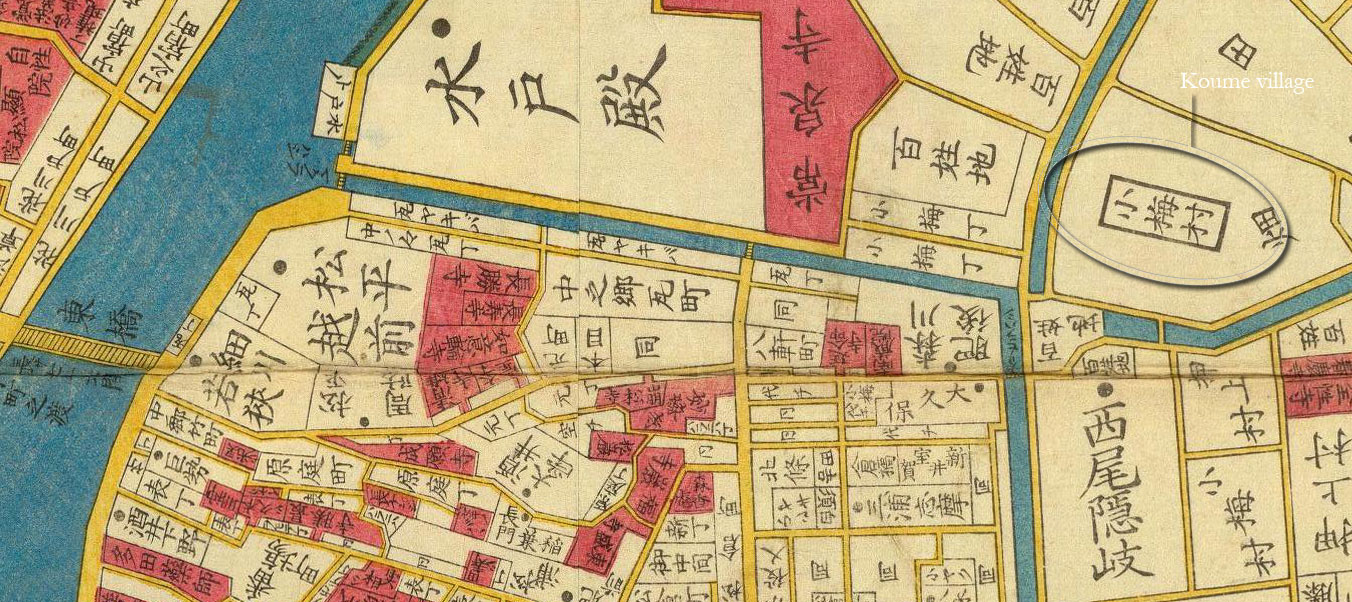
According to the title of this print, in the mid-distance boats are anchored at Koume village (小梅村, meaning “Little Plum village”). Koume village is actually located some 2.5 kilometres inland from the east bank of the river, as is indicated on this detail of an Edo map from 1858:
|
Location of Koume village relative to the Sumida river |
In 1876 the wooden Ōkawa bridge was rebuilt and renamed Azuma bridge (吾妻橋, which literally translates into “My wife’s bridge”). Subsequently, the bridge was rebuilt several times. This is a picture of the current bridge constructed in 1931 that I took while visiting Japan in 2017 (click to enlarge):

|
Current view of Azuma bridge |
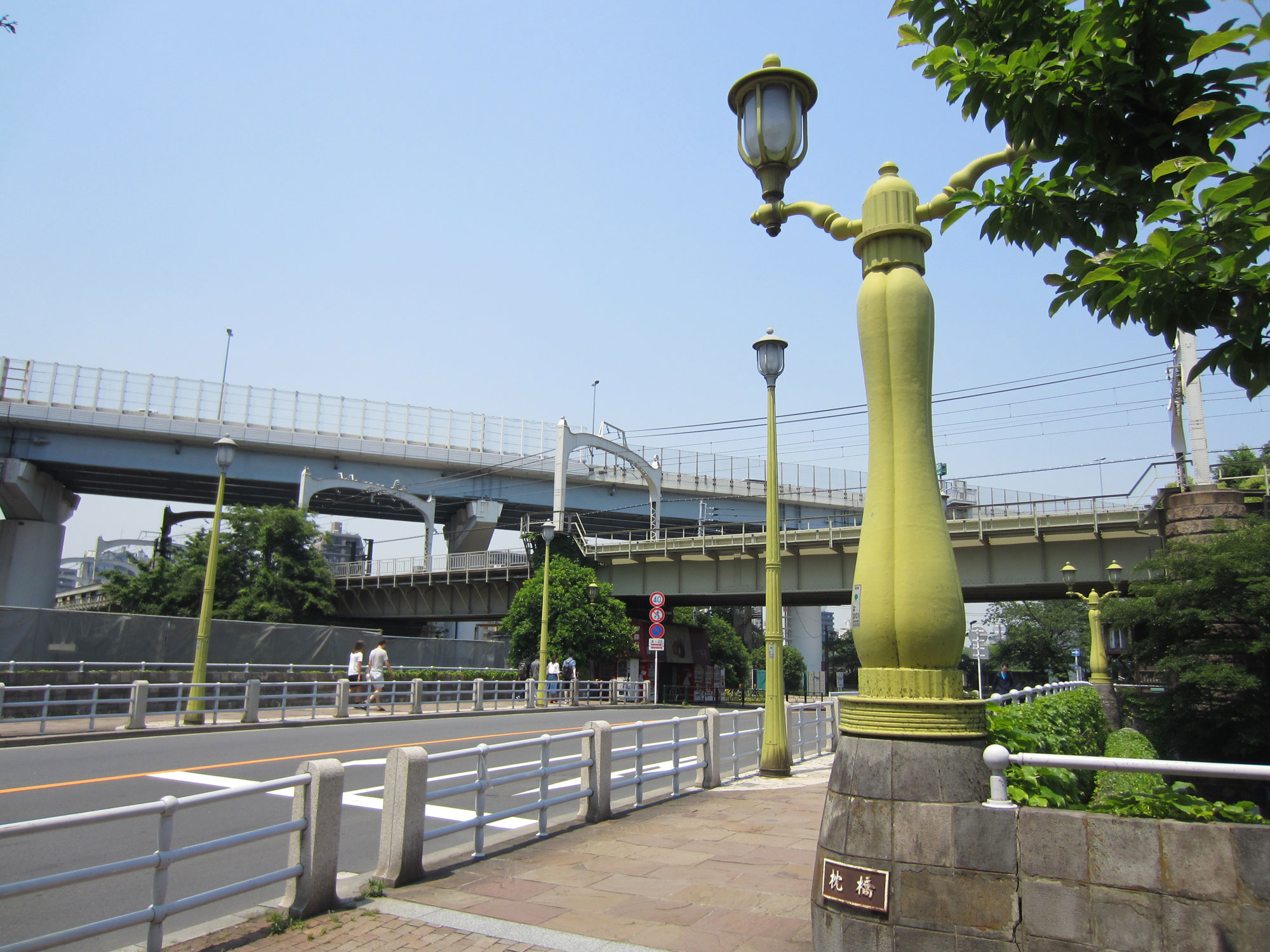
And here is a picture I took in 2017 of Makura bridge as it looks today (click to enlarge):
|
Current view of Makura bridge |